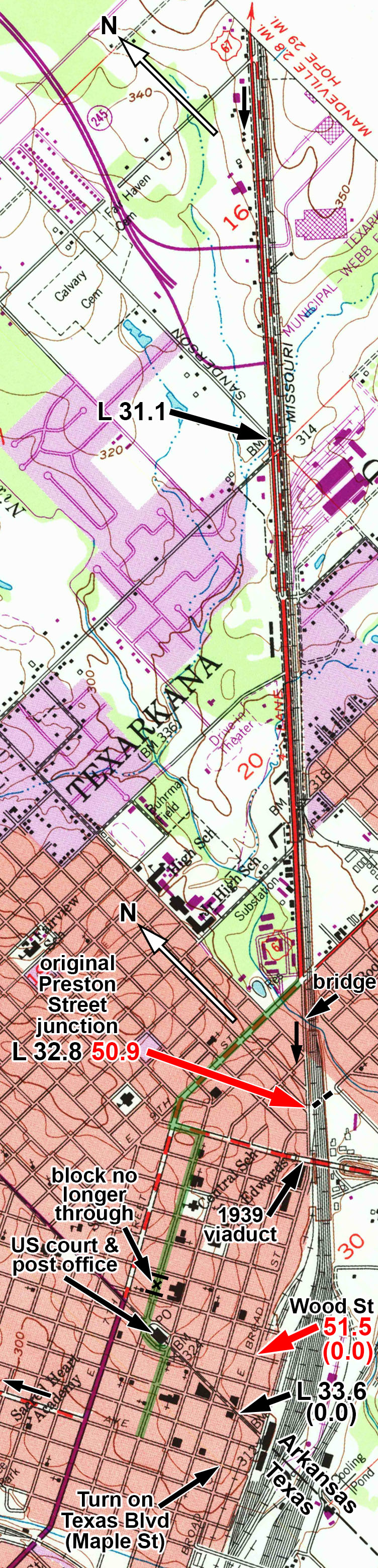
Map number 45.
This is the Texarkana 7.5-minute quad from 1954 (revised 1975). The 1909 and 1954 15-minute quads, and the 1954 7.5-minute quad were available, and I consulted them to see the early alignment of US 67, which was the Bankhead. North is to the up and to left on this map, so up is northeast.
This shows Texarkana, Arkansas and Texas.
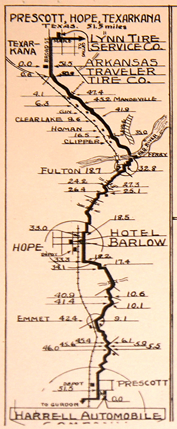
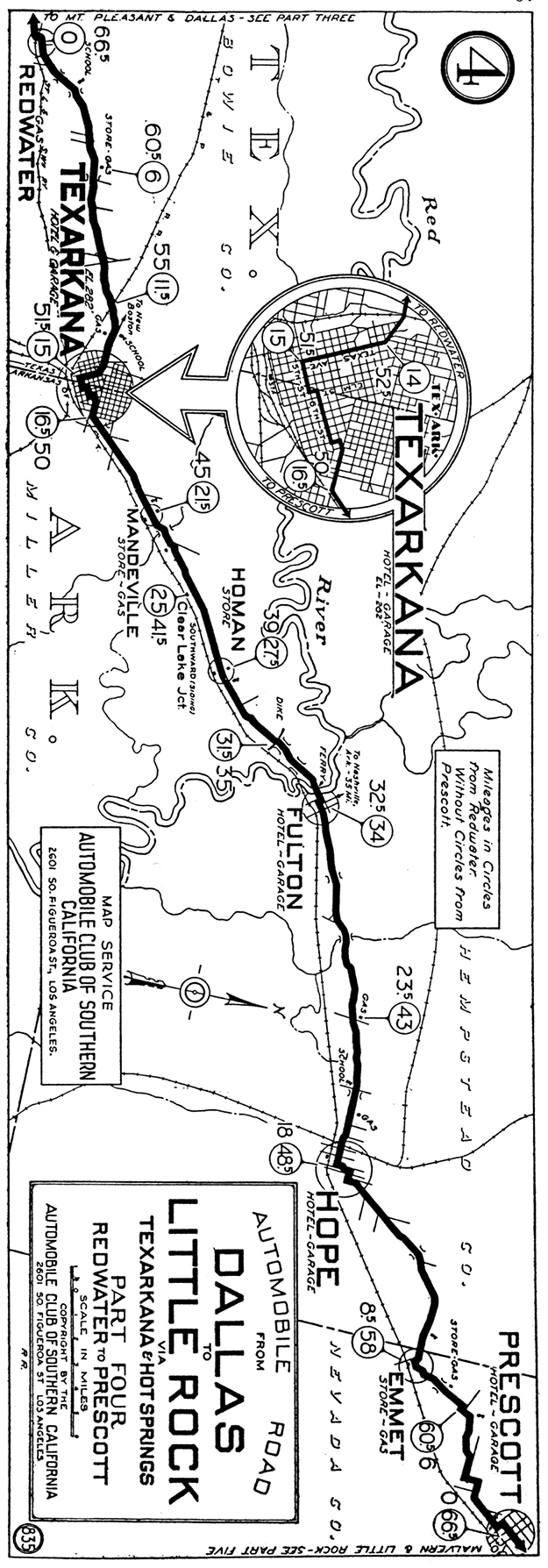
According to both the Locke and Dunn guides, the Bankhead highway followed Broad Street into downtown Texarkana. It then went north on Texas Blvd, which at that time was still Maple Street. The 1928 ACSC strip map shows a route approximately parallel to the current routes of US 67, 71, and 82, which travel on 8th Street (MLK Blvd) westbound and 7th Street eastbound. The 1928 map moves off the Bankhead route along 9th Street (as did US 67). It then went west on 7th Street (eastbound only now) and turned south on Hickory Street to 6th Street. It followed 6th Street west to the large traffic circle around the Federal building, and went along it to 5th Street. it then followed 5th Street to Texas Blvd. This is shown highlighted in green on the map.
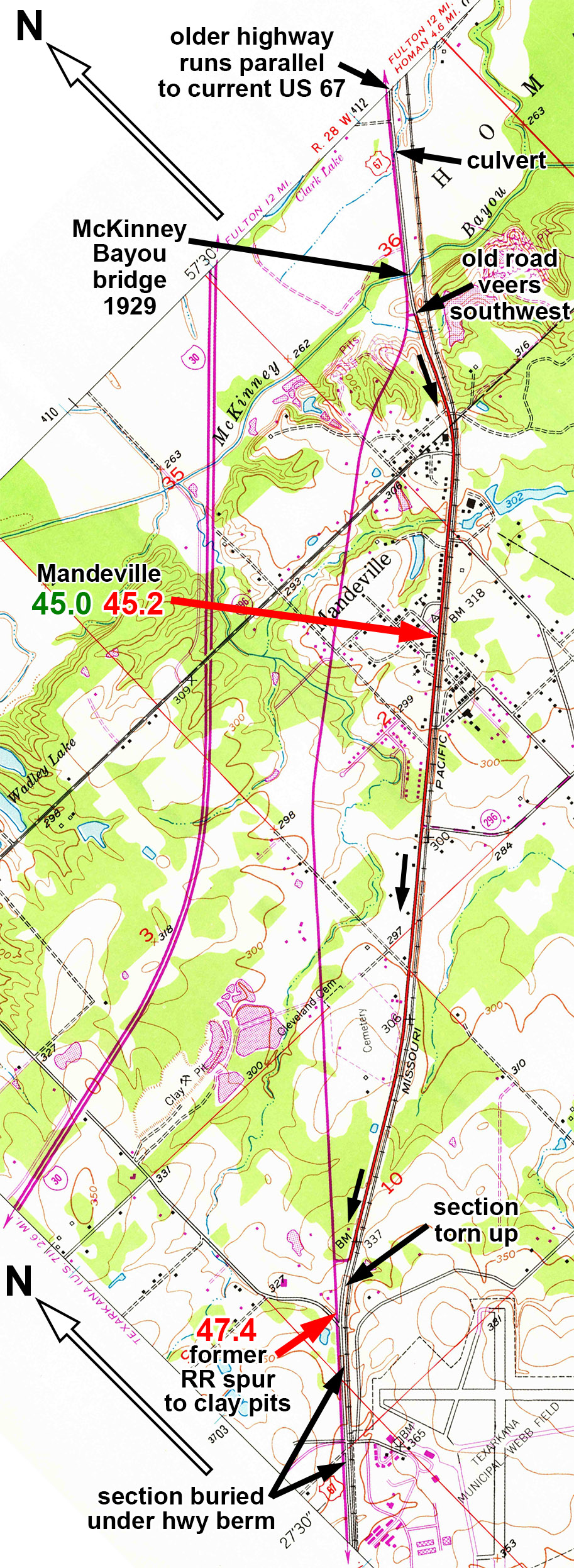
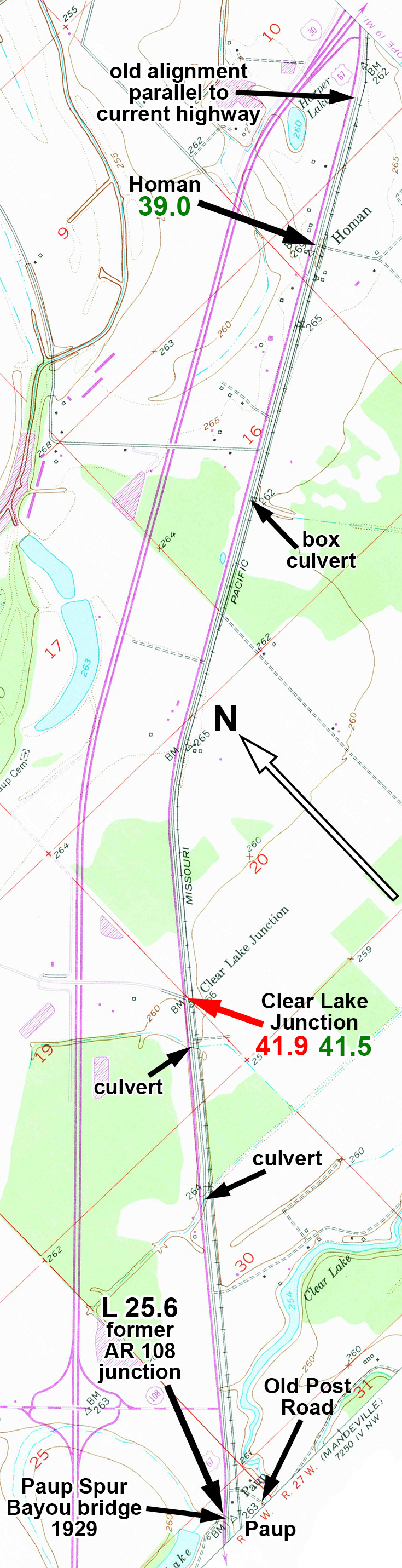
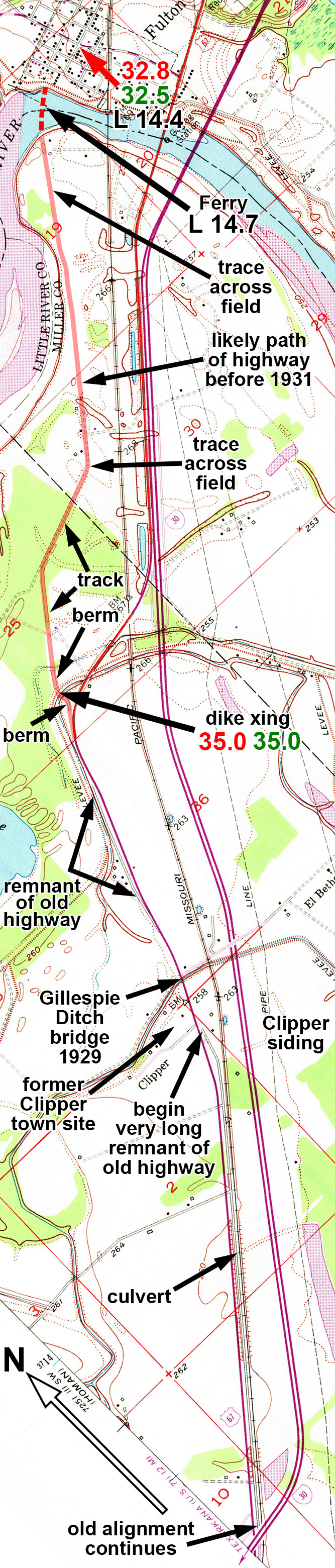
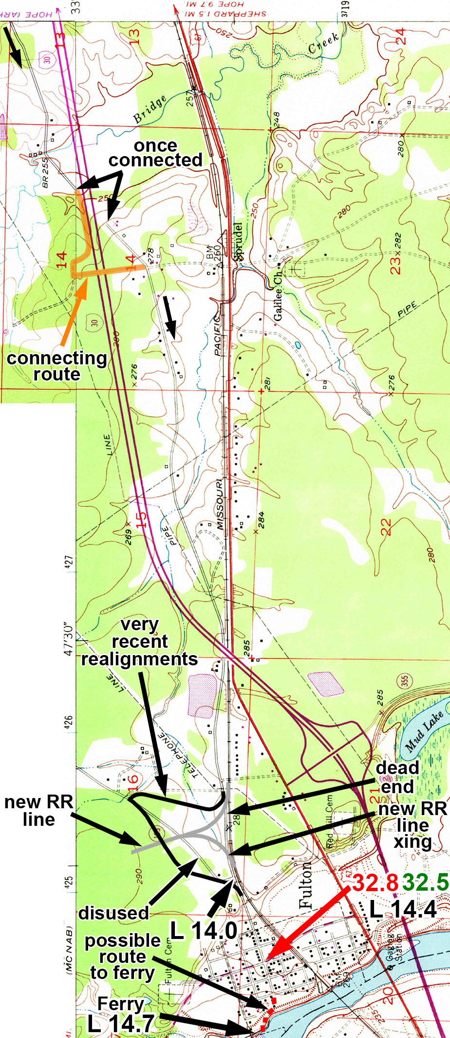
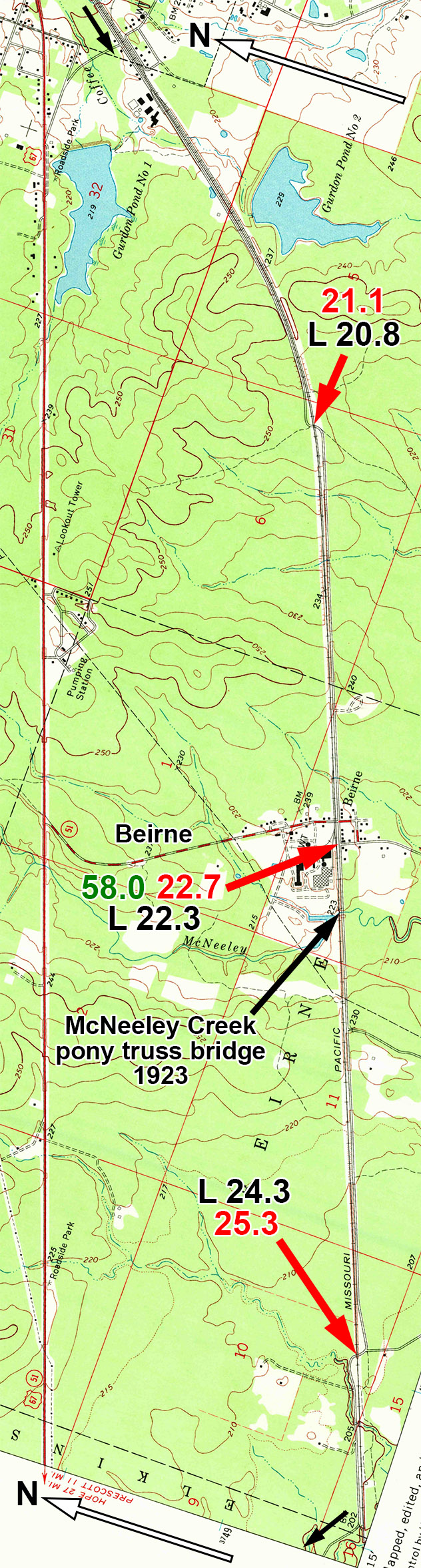
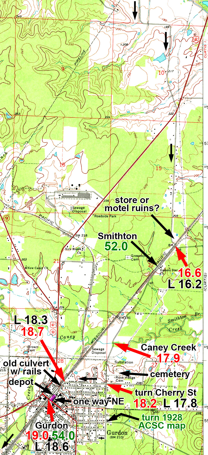
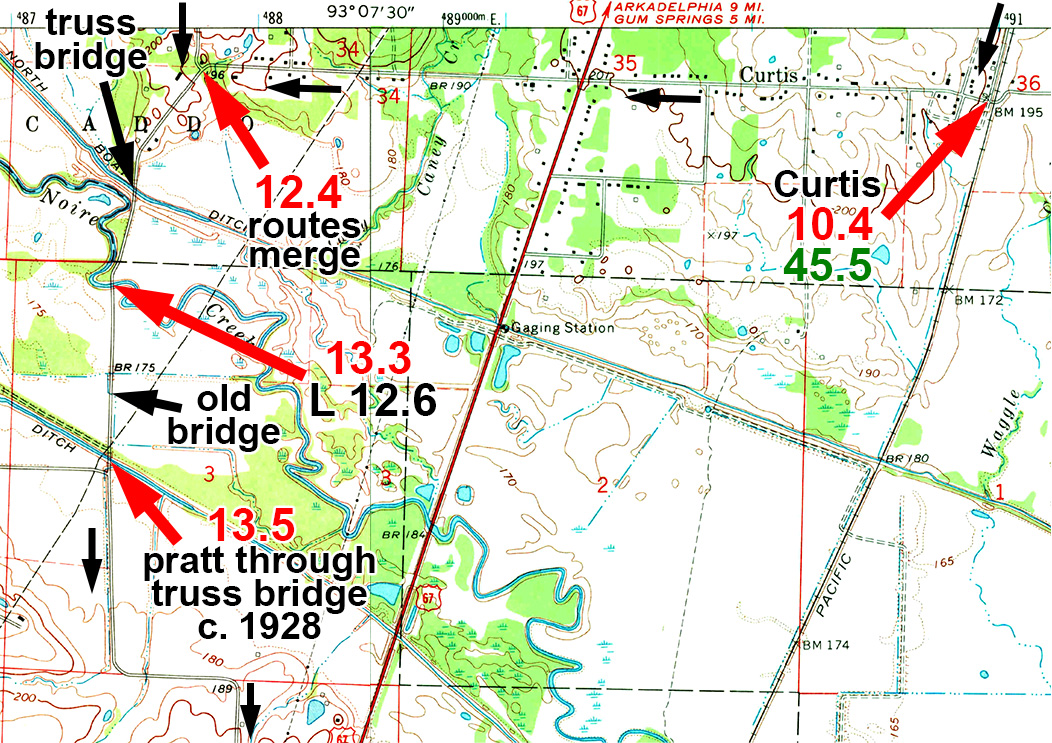
Red = Dunn guide. Black mileage = Locke guide. Green = 1928 ACSC strip map mileages.
This is the Texarkana 7.5-minute quad from 1954 (revised 1975). The 1909 and 1954 15-minute quads, and the 1954 7.5-minute quad were available, and I consulted them to see the early alignment of US 67, which was the Bankhead. North is to the up and to left on this map, so up is northeast.
This shows Texarkana, Arkansas and Texas.
According to both the Locke and Dunn guides, the Bankhead highway followed Broad Street into downtown Texarkana. It then went north on Texas Blvd, which at that time was still Maple Street. The 1928 ACSC strip map shows a route approximately parallel to the current routes of US 67, 71, and 82, which travel on 8th Street (MLK Blvd) westbound and 7th Street eastbound. The 1928 map moves off the Bankhead route along 9th Street (as did US 67). It then went west on 7th Street (eastbound only now) and turned south on Hickory Street to 6th Street. It followed 6th Street west to the large traffic circle around the Federal building, and went along it to 5th Street. it then followed 5th Street to Texas Blvd. This is shown highlighted in green on the map.
Red = Dunn guide. Black mileage = Locke guide. Green = 1928 ACSC strip map mileages.